Western Washington braces for powerful storm systems this week, with expected impacts including heavy mountain snow, gusty winds, and rainfall.
SEATTLE — The National Weather Service issued a Blizzard Warning for the Cascade Mountains this week due to forecasted heavy snow and gusty winds.
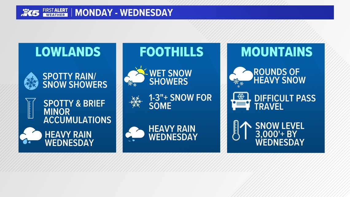
Western Washington is expected to experience several storm systems this week, bringing colder temperatures, gusty winds, periods of rain, and heavy snow in the mountains. The most widespread impacts are expected Wednesday, when heavier rain, stronger winds, and continued mountain snowfall are in the forecast.
The criteria for NWS to issue a Blizzard Warning include large amounts of snow, wind exceeding 35 mph and visibility of less than a quarter of a mile — all sustained for at least three hours. While snow is common in the Cascades, sustained winds during a snow event are less so.
NWS Seattle has issued just seven Blizzard Warnings, four of those in the last two years.
Here’s a look at what to expect in the next 24 to 48 hours in the mountains.
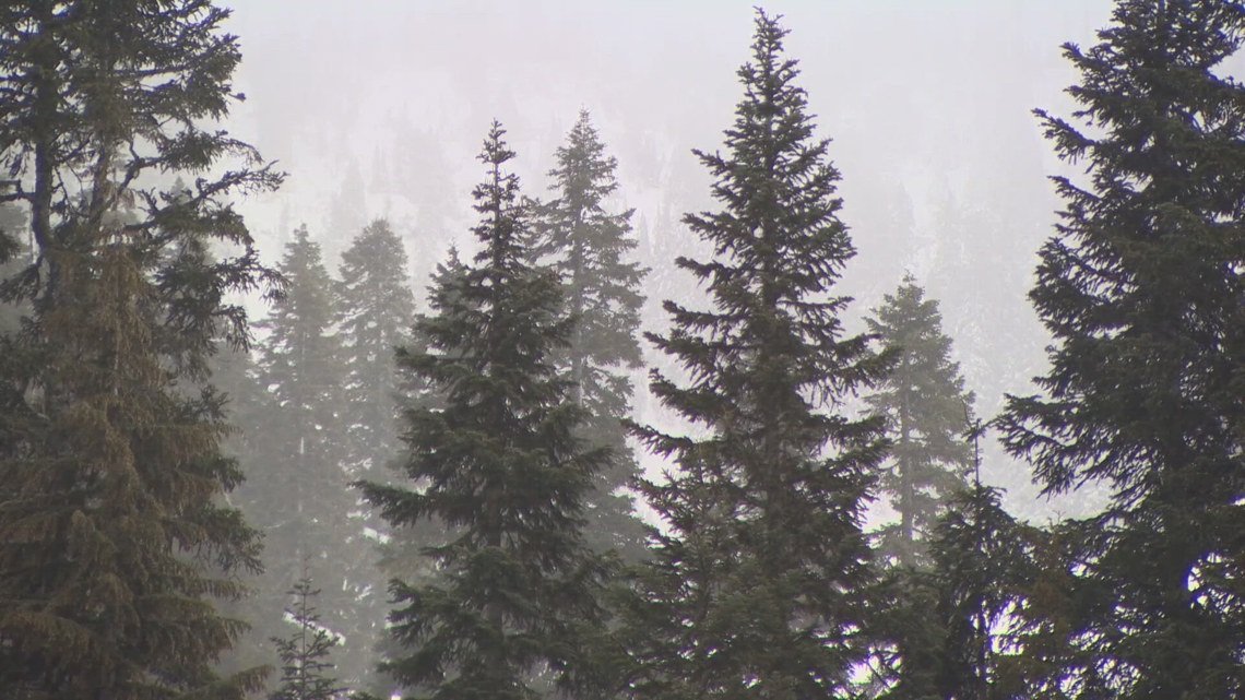
Winter alerts for the Cascades
Weather alerts have been issued for the Cascade Mountains as significant snowfall is expected.
- Winter Storm Warning (in effect through 5 a.m. Tuesday): Areas from Stevens Pass and Highway 2 northward could receive 12 to 18 inches or more of snow, along with wind gusts up to 35 mph. Travel across mountain passes could become difficult.
- Winter Weather Advisory (in effect until 5 p.m. Tuesday): Areas from Snoqualmie Pass southward may see between 6 to 14 inches of snow depending on the area, which could create tricky driving conditions.
- Blizzard Warning (in effect 5 p.m. Tuesday to 11 p.m. Wednesday): The western slopes of the Cascades could experience blizzard conditions, including winds gusting up to 40 miles per hour and snow accumulations between 2 and 4 feet. The weather service warns visibility on roadways could drop below a quarter mile due to falling and blowing snow.
Monday and Tuesday
The unsettled pattern is expected to continue Monday and Tuesday, with colder air increasing the chance for a rain and snow mix in lowland areas, mainly during overnight and early morning hours.
Overnight temperatures are expected to hover near freezing, while daytime highs should reach the 40s.
Possible snow amounts include:
- Foothills: A few inches of wet snow could accumulate Tuesday morning.
- Below 500 feet: Brief, light accumulations of less than one inch may occur during early morning hours.
Major disruptions in lowland areas are not anticipated.

Tuesday into Wednesday:
A more powerful system is expected to arrive Tuesday night and continue into Wednesday, bringing the most significant impacts of the week.
A Winter Storm Watch is expected to go into effect from Wednesday evening through Friday morning.
KING 5 has activated First Alert for this weather event, which could affect lives, property or travel in the Pacific Northwest region. During this event, the First Alert Weather Team will bring you the latest information to keep you and your family safe.
In lowland areas, rain will increase and could become heavy at times, especially Wednesday. Wind gusts between 30 and 40 mph are possible, which could make commutes more challenging. The strongest winds are expected to peak Wednesday night, according to the National Weather Service.
Mountain areas are expected to continue receiving heavy snowfall, with snow levels rising to about 2,500 to 3,000 feet on Wednesday.
Some communities may briefly see a rain-and-snow mix or short bursts of wet snow, but widespread disruptions in the lowlands are not currently expected. Minor impacts remain possible in foothill areas.
Expected precipitation totals
Through Friday, the region could see significant precipitation totals:
- Lowlands: 1 to 3 inches of rain, with the heaviest amounts likely Wednesday
- Coastal areas and the Olympics: 2 to 4 inches of rain
- Mountains: 2 to 5 feet of snow
Travelers, especially those heading over mountain passes, should prepare for winter driving conditions and monitor the latest forecasts throughout the week.
Forecast details may change. Check back in for updates.