It’ll be foggy, soggy and stormy over next 24 hours, with an elevated risk of flooding from more heavy storms.
INDIANAPOLIS —
Foggy & too soggy: Central Indiana swamped by soaking rain
Parts of central Indiana are dealing with serious high water and dense fog after an incredible 24-hour rainfall event.
Nearly 3.5 inches of rain fell in Indianapolis, which is more liquid than what we measured from melted snow during January and February combined. That’s a remarkable statistic for early March!

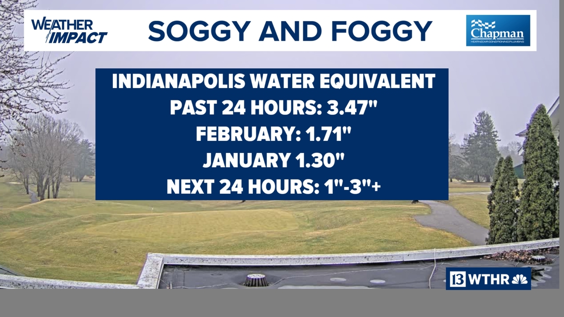

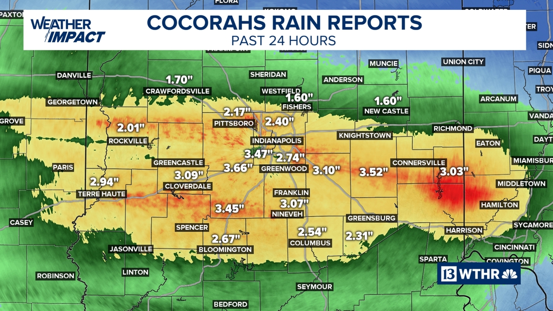

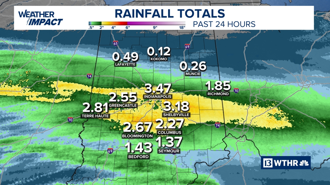
A wide swath of 2 to 4 inches of rain fell along and just south of the I-70 corridor, where areas of flooding continue at this hour. Ponding on roads, swollen creeks and standing water in low-lying areas remain concerns.
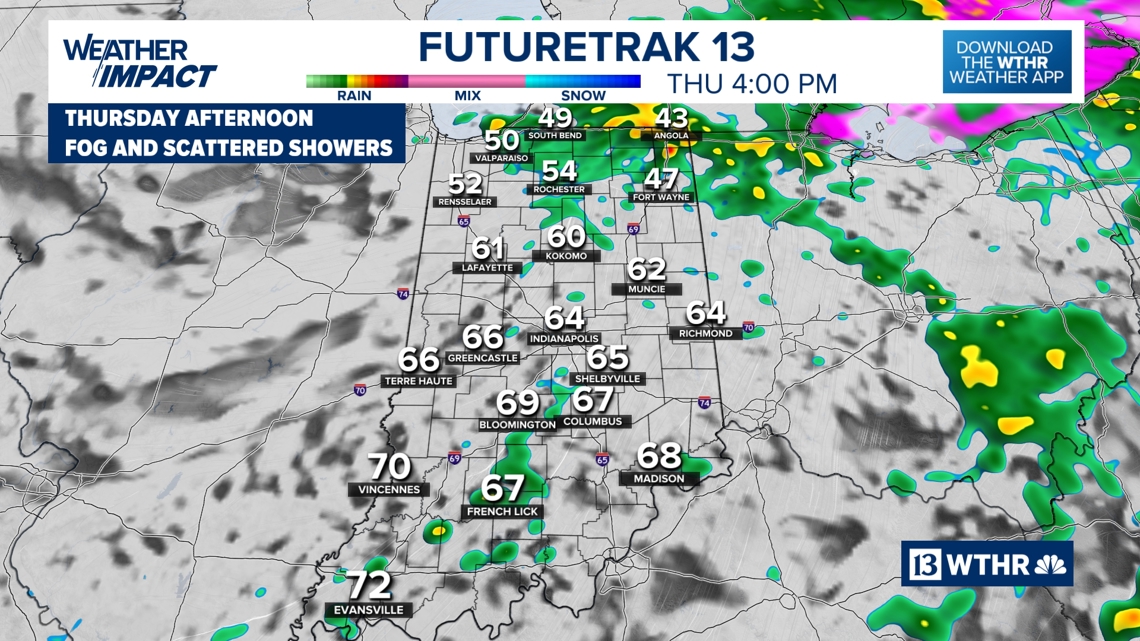
Areas of dense fog
In the same zone hardest hit by rainfall, dense fog has reduced visibility to near zero at times. That limited visibility will continue periodically today, creating dangerous travel conditions.

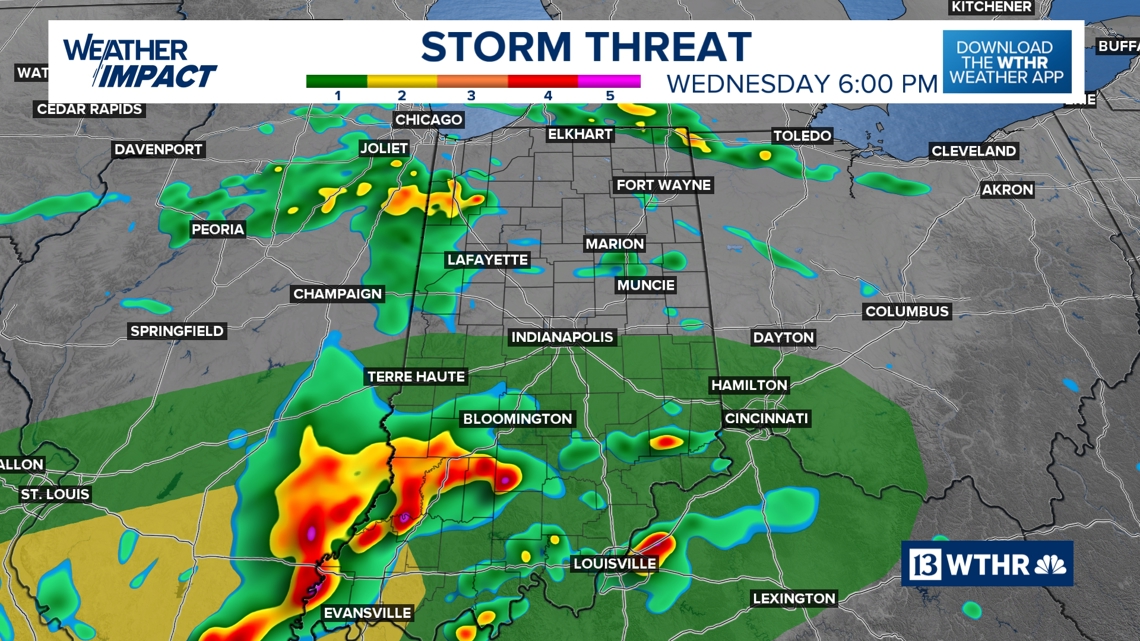

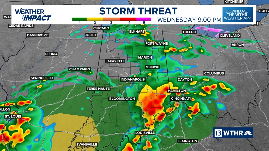
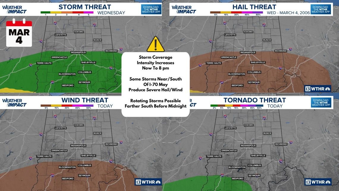
Storms increase remainder of today
Storm coverage and intensity will increase through the afternoon, especially across the central and southern half of Indiana.
A Level 1 out of 5 severe risk is in place.
Possible threats include:
-
Pea- to nickel-sized hail
-
Wind gusts over 60 mph
-
Isolated rotating storms across far southern and southwestern Indiana near an approaching warm front
While the overall severe threat is low, any stronger storm could briefly become severe.

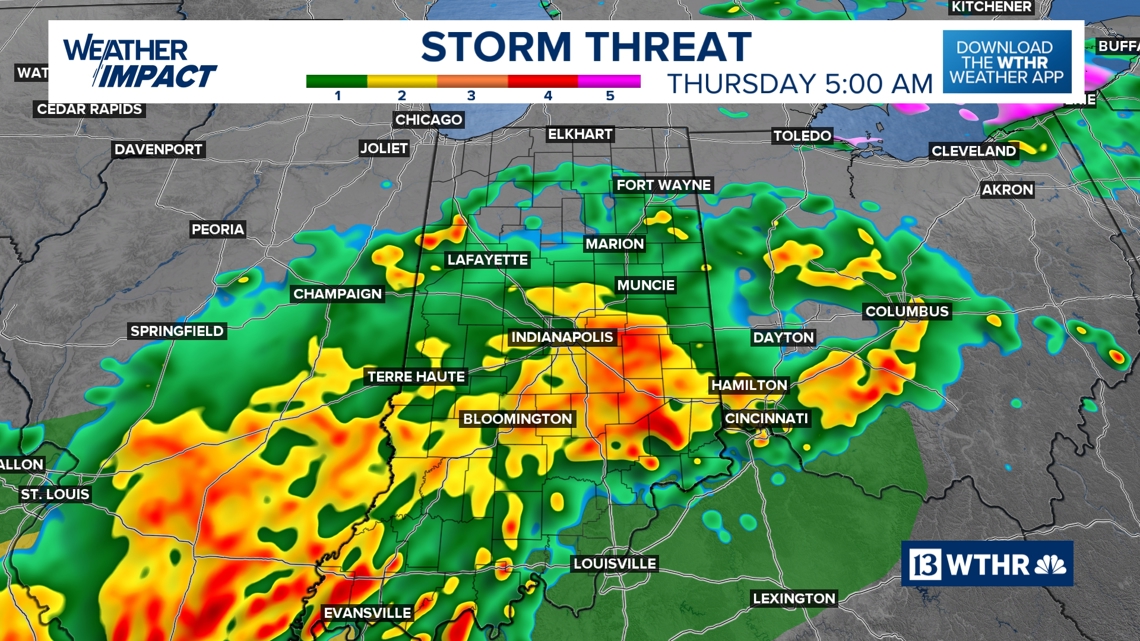
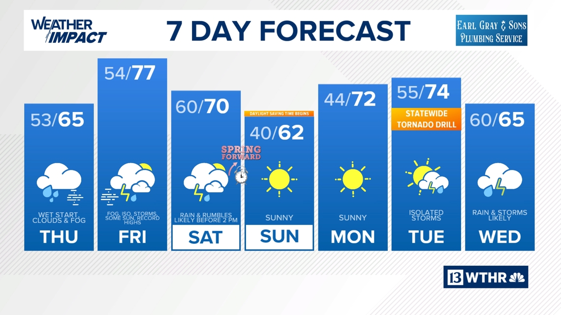
Multiple waves of rain ahead
We’re expecting more than one round of rain and thunderstorms.
Rain coverage will gradually diminish Thursday afternoon, but fog may linger into Friday morning.


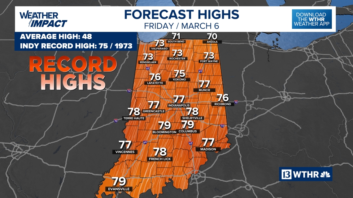
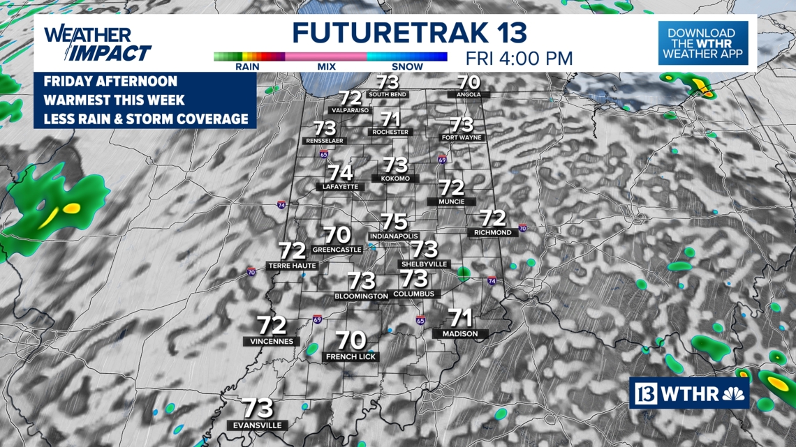
Record warmth incoming Friday
After the soggy stretch, we flip the script to springlike — even summerlike — warmth.
The forecast high in Indianapolis on Friday is 75° to near 80°.
Record highs are possible.
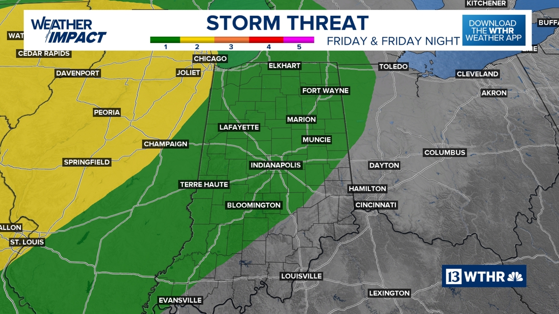
There is a low risk of severe storms Friday, but the main lifting mechanism appears displaced west of Indiana. Most areas should see only isolated showers or storms. Still, any storm that does form could strengthen — we’ll monitor closely.


Weekend outlook
Don’t forget: Spring forward!
At 2 a.m. Sunday, we switch to Daylight Saving Time.
Set your clocks ahead one hour before bed Saturday night!
Stay Weather Aware
With flooding, fog, and multiple storm rounds ahead, it’s important to:
-
Never drive through flooded roads
-
Keep weather alerts enabled
-
Check back frequently for forecast updates
We’ll continue to track the rain, the fog, the severe potential and the record warmth ahead.
Stay with WTHR-TV for the latest updates.