Severe storms, with potential for damaging winds and isolated tornadoes, are expected in Houston Wednesday afternoon, warns the KHOU 11 Weather Team.
HOUSTON — A Weather Impact Alert has been issued for Wednesday as forecasters warn that strong storms could bring heavy rain, damaging winds and the possibility of an isolated tornado to the Houston area. KHOU 11 will be streaming updates all day.
The best way to stay ahead of the weather is to get the free KHOU 11+ app. We will have live updates throughout the day with updates on the storms.
KHOU 11 meteorologist David Paul says the same warm, humid air that made conditions feel like early summer Tuesday will help fuel thunderstorms moving into Southeast Texas. The storms are expected to be similar to the intense downpours that hit the region Saturday, but with potentially broader coverage.
Forecasters say the threat is tied to a storm system moving out of northern Mexico and the Southwest that will bring increasing rain and storms throughout the day Wednesday.
Timeline for Wednesday’s storms
Morning (around 7 a.m.)
-
Scattered showers begin developing across the Houston area.
-
Rain chances around 30%, with most storms expected to remain west along the Interstate 35 corridor earlier in the day.
Late morning to noon
-
Rain chances increase to about 40%.
-
A few scattered showers are possible, but the more intense activity is still expected later in the day.

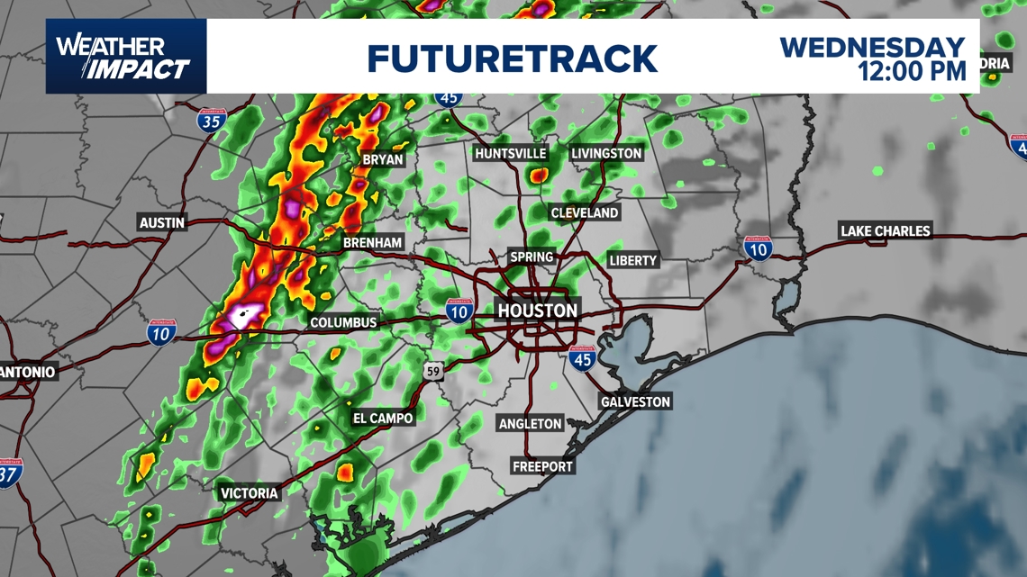
Early afternoon (around 1:30 p.m.)
Mid-afternoon through evening (2:30 p.m. – evening commute)

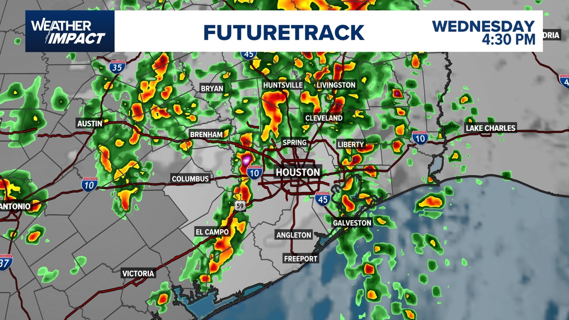
Severe threat window (roughly 1 p.m. – 9 p.m.)
Evening (around 8–9 p.m.)


Late evening to overnight (9 p.m. – 1 a.m.)
-
Widespread rain may continue as the main storm system moves through.
-
Lightning and thunder remain possible, but severe storms should be less likely.
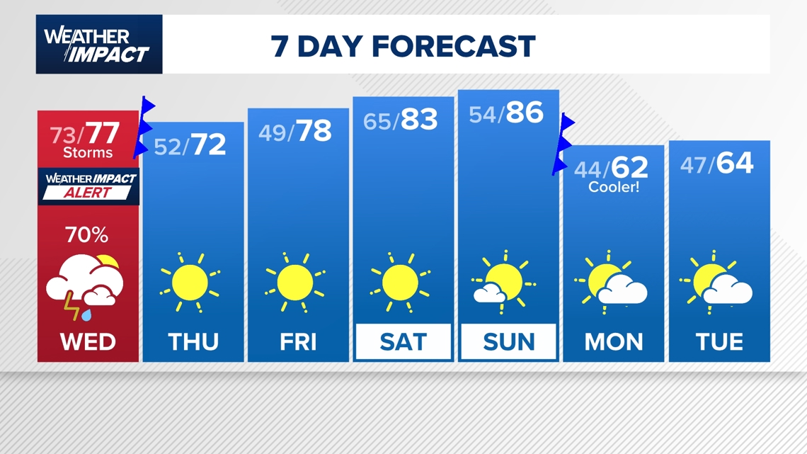
Rainfall totals across Southeast Texas are expected to range from about half an inch to 2 inches, though isolated areas could see higher amounts during heavier downpours.
Forecasters say the storms will also mark the beginning of a pattern change. Once the system moves out early Thursday morning, cooler and drier air will move in, bringing several days of clear and comfortable weather before another cold front arrives early next week.
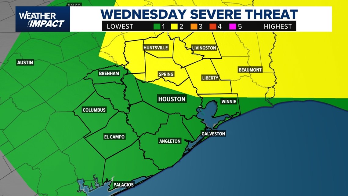
Main threats: Wind damage and isolated tornadoes
If storms strengthen Wednesday afternoon and evening, the primary hazards could include:
- Damaging wind gusts
- An isolated tornado
- Heavy downpours
Forecast graphics also show isolated tornadoes are possible across parts of Southeast Texas.
Localized flooding cannot be ruled out where heavy rain develops, though the broader flood threat across the Houston area currently appears limited.
What this means for the evening commute
The timing of the storms could create problems during the evening commute across the Houston metro area.
Drivers may encounter heavy rain, lightning and strong wind gusts, especially late in the afternoon and early evening when storms are expected to move through the region.
Residents are encouraged to monitor the forecast closely Wednesday and be prepared for changing conditions.
Looking ahead
After the storms move through, the weather pattern shifts quickly.
Thursday is expected to turn drier, sunnier and cooler, providing a break from the unsettled conditions.
Temperatures will gradually warm again heading into the weekend before another cooler air mass arrives early next week, bringing noticeably chillier temperatures by Monday.

Harris County (including Houston, Pasadena, Baytown), Fort Bend County (Richmond, Sugar Land, Missouri City), Montgomery County (Conroe, The Woodlands), Brazoria County (Angleton, Pearland, Alvin, Lake Jackson), Galveston County (Galveston, League City, Texas City), Liberty County (Liberty, Cleveland, Dayton), Walker County (Huntsville, New Waverly), Waller County (Hempstead, Prairie View, Waller), Polk County (Livingston, Corrigan), Chambers County (Anahuac, Mont Belvieu, Winnie), Wharton County (Wharton, El Campo), Washington County (Brenham), Matagorda County (Bay City, Palacios), Grimes County (Anderson, Navasota), Austin County (Bellville, Sealy), Colorado County (Columbus, Eagle Lake, Weimar), Trinity County (Groveton, Trinity).